Vector Data
Vector data consists of potentially linked points defined by coordinates that can form complex geometries with assigned attributes.
Vector data model
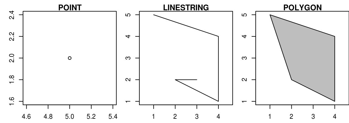
In a Cartesian coordinate system, which is necessary for the representation of a Euclidean geometry, arbitrarily complex spatial structures for the modelling of geoobjects can be constructed starting from the most basic element: a single point.
If there is more than one point – or node in topological notation – in the coordinate system we can connect these points by a line or a linestring, which is topologically called an edge.
If more than two points are connected by an edge and a closed surface arises, we speak of a polygon or topologically of a mesh. In the context of spatial data and Geographic Information Systems, nodes are usually referred to as points, non-closed connections of edges as lines, and meshes as polygons.
More Information
- More detailed information for vector data can be found at Geocomputation with R - Vector data.
Comments?
You can leave comments under this issue if you have questions or comments about the content on this page. Please copy the corresponding line into your comment to make it easier to answer the question.