Vector Data
Vector data consists of potentially linked points defined by coordinates that can form complex geometries with assigned attributes.
Vector data model
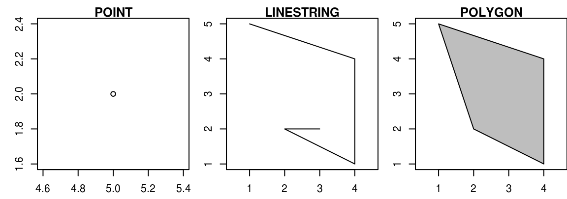
In a Cartesian coordinate system, which is necessary for the representation of a Euclidean geometry, arbitrarily complex spatial structures for the modelling of geoobjects can be constructed starting from the most basic element: a single point.
If there is more than one point – or node in topological notation – in the coordinate system we can connect these points by a line or a linestring, which is topologically called an edge.
If more than two points are connected by an edge and a closed surface arises, we speak of a polygon or topologically of a mesh. In the context of spatial data and Geographic Information Systems, nodes are usually referred to as points, non-closed connections of edges as lines, and meshes as polygons.
Vector data formats
Why you should use Geopackage instead of Shapefile
| GeoPackage | Shapefile |
|---|---|
| OGC standard, Open | Owned by ESRI |
| Database structure | |
| Single file (.gpkg) | Multi File (.shp,.dbf.,.shx,.prj) |
| Flexible | Only one Geometry type per file |
| There are nearly no limitations | File size is restricted to 2 GB, No real 3D support, Attributes only 10 letters |
More Information
- More detailed information for vector data can be found at Geocomputation with R - Vector data.